1.3K
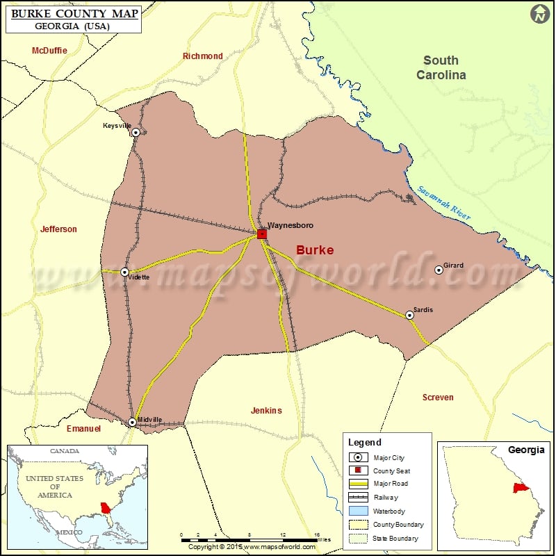
Check this Georgia County Map to locate all the state’s counties in Georgia Map.
Mountain Peaks in Burke County
| Mountain Peak/Hill | Elevation [Meter] |
|---|---|
| High Head | 51 |
| Potlikker Hill | 50 |
More Maps of Burke County
Airports in Burke County
| Airport Name |
|---|
| Burke County Airport |
| Burke County Hospital Heliport |
| Midville International Airport |
| Rhodes Air Ranch Airport |
| Sandy Hill Airport |
| Vogtle Electric Generating Plant Heliport |
Cities in Burke County
| City | Population | Latitude | Longitude |
|---|---|---|---|
| Girard town | 156 | 33.039951 | -81.712176 |
| Keysville city | 332 | 33.237433 | -82.228943 |
| Midville city | 269 | 32.821751 | -82.234606 |
| Sardis city | 999 | 32.975581 | -81.762124 |
| Vidette city | 112 | 33.037586 | -82.247438 |
| Waynesboro city | 5766 | 33.091112 | -82.014591 |
Golf Courses in Burke County
| Name of Golf Course | Latitude | Longitude |
|---|---|---|
| Applewood Golf Course-Keysville | 33.194702 | -82.078264 |
| Waynesboro Country Club-Waynesboro | 33.065488 | -82.022379 |
 Wall Maps