- Connecticut Counties - Connecticut County Map, Map of Connecticut Counties
- Major Cities of Connecticut - Hartford, New London, Waterbury
- Neighbouring States - Massachusetts, Rhode Island, New York
- Regional Maps - Map of USA
- Other Connecticut Maps - Connecticut Map, Where is Connecticut, Connecticut Physical Map, Connecticut Lat Long Map, Connecticut Zip Code Map, Connecticut Area Code
Airports in Connecticut
Connecticut is the wealthiest state in the USA and as a result airports in Connecticut attract a lot of traffic. Airports in Connecticut connect the state to practically every state in the USA. Airports in Connecticut are a well-maintained lot.
Major Airports in Connecticut
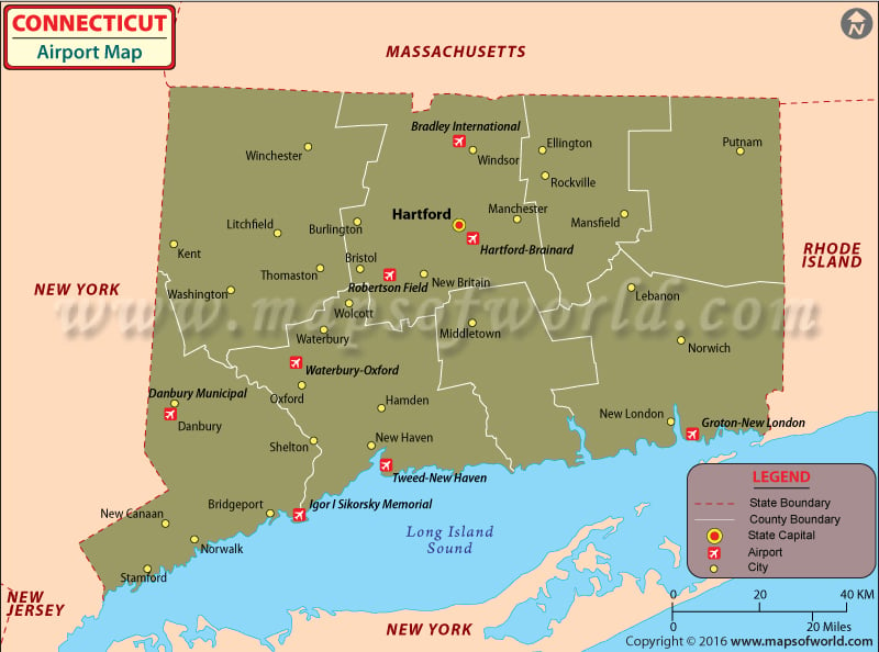
There are many airports in Connecticut, despite the state being a small one. Of all the airports in Connecticut only one is an international airport. Bradley International Airport in the city of Windsor Locks welcomes passengers from all over the globe. This airport has 17 major airlines flying daily from its runway. It is disabled-friendly as it has wheel chairs, assistants to help people with disabilities and telecommunication devices specially built for the speech and hearing impaired. The Bradley International Airport receives 8 million passengers annually. The major airlines operating from here are
United Airline, Delta Airlines, Continental Airlines, American Airlines, Southwest Airline and US Airways express.
Other important airports in Connecticut are the Groton-New London Airport in Groton is there to enjoy different London Tourist Attraction, Tweed-New Haven Airport in New Haven and the Igor I. Sikorsky Memorial Airport in Bridgeport.
The airports in Connecticut have a friendly staff who assist passengers with their travel and are readily available for any help.
Most of the airlines flying from the airports of Connecticut offer online booking of tickets, which can be done from their individual websites.
Maps of Major Airports in Connecticut
List of Airports in Connecticut |
|---|
| Airport Name | City | Coordinates |
|---|---|---|
| Bradley International Airport | Hartford | 41°56′21″N 072°41′00″W |
| Tweed New Haven Regional Airport | New Haven | 41°15′50″N 072°53′12″W |
| Goodspeed Airport | East Haddam | 41°26′44″N 72°27′20″W |
| Ellington Airport | Ellington | 41°55′32″N 072°27′26″W |
| Salmon River Airfield | Marlborough | 41°35′22″N 72°26′32″W |
| Candlelight Farms Airport | New Milford | 41°34′09″N 73°27′43″W |
| Toutant Airport | Putnam | 41°57′20″N 72°3′15″W |
| Skylark Airpark | Warehouse Point | 41°55′42″N 72°34′35″W |
| Waterbury Airport | Waterbury | 41°38′00″N 73°02′48″W |
 Wall Maps