24.9K
- Neighboring Countries - Isle of Man, Ireland, Netherlands, Belgium, France
- Continent And Regions - Europe Map
- Other United Kingdom Maps - UK Map, Where is UK, UK Blank Map, UK Road Map, UK Rail Map, UK Cities Map, UK Political Map, UK Physical Map, UK Flag
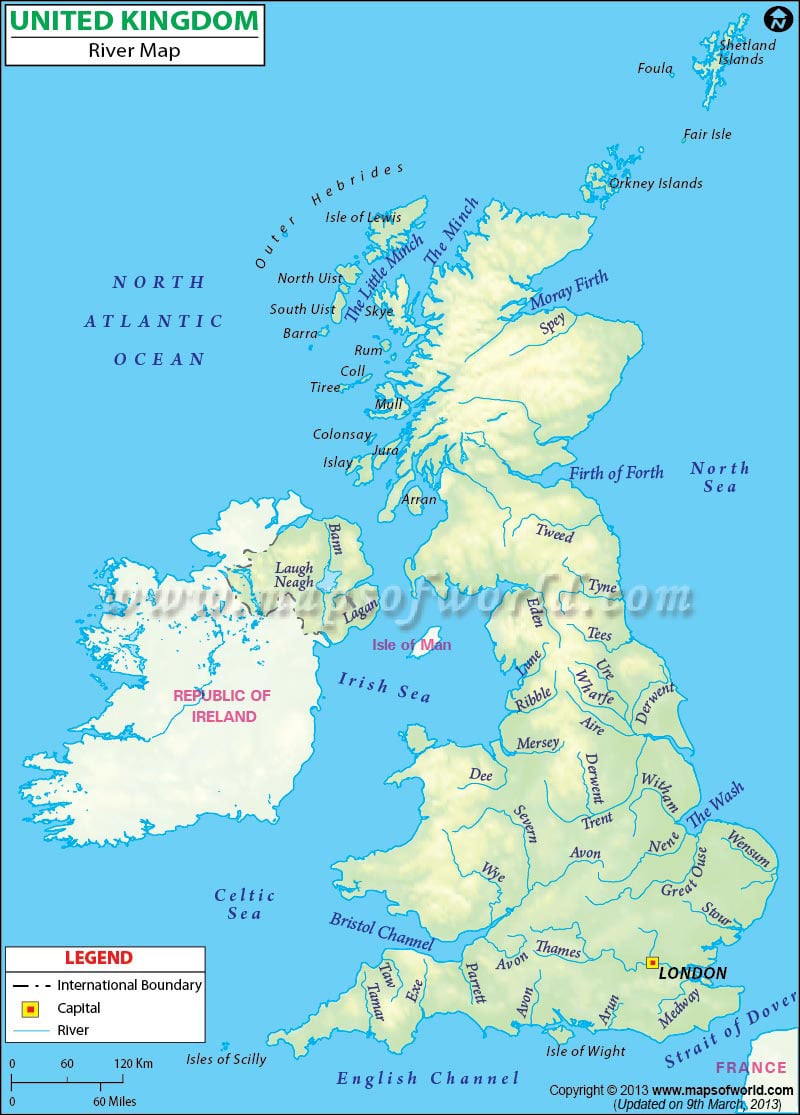
Major Rivers in the United Kingdom |
|---|
| River | Length (km) | Length (miles) | Drainage area (km²) | Outflow | Countries in the drainage basin | UK countries in the drainage basin |
|---|---|---|---|---|---|---|
| River Severn | 354 | 220 | 11420 | Severn Estuary | UK | Wales, England |
| River Thames | 346 | 215 | 12935 | Thames Estuary, North Sea | UK | Southern England |
| River Trent | 298 | 185 | 10435 | Trent Falls, Humber | UK | England |
| River Wye | 215 | 134 | 4136 | Severn Estuary | UK | Wales, England |
| River Tyne | 321 | 200 | 2933 | Tynemouth | UK | North East England |
| River Avon | 137 | 85 | 2670 | River Severn | UK | Midlands of England |
| River Tweed | 156 | 97 | 3900 | North Sea | UK | Scotland, England |
| River Great Ouse | 230 | 143 | 3400 | North Sea | UK | Central England |
| River Tay | 188 | 117 | 4970 | Firth of Tay | UK | Scotland |
| River Spey | 172 | 107 | 3008 | Moray Firth | UK | Scotland |
Locations in the Map
Major Locations: Ullapool, Portree, Inverness, Aberdeen, Dundee, Glasgow, Edinburgh, Newcastle, Londonderry, Isle of Man, Liverpool, Leeds, Kinson Upon Hull, Manchester, Birmingham, Fishguard, Cardiff, Norwich, London, Plymouth, Southampton, Brighton, Bover.
Oceans, Seas, River, Bays & Canals: North Atlantic Ocean, North Sea, English Channel
