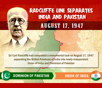
Click to view full Infographic After five weeks on the subcontinent, Sir Cyril Radcliffe had completed a monumental task on August 17, 1947: separating the former British Provinces of India into the newly-independent Union of India and Dominion of Pakistan. Believing he had found the most equitable solution available given the territory’s wide diversity of cultures and terrain, Radcliffe soon returned to his homeland without realizing he had created one of the major points of contention in the world even today – the border between India and Pakistan. Upon making it to India on July 8th, Radcliffe immediately went to work connecting with others who might give him insight on how to divide more than 175,000 square miles between very different factions in the former provinces. Working with two representatives from the Indian National Congress and a pair from the Muslim League, creating a border by the designated date for British withdrawal – August 15th – would be no easy task. In addition to determining how best to manage natural borders and split infrastructure fairly, Radcliffe sought to use social factors like religion in helping him determine where the separation should occur. On first glance, the decision seemed rather straightforward. Provinces that were predominantly Muslim would become part of Pakistan and those with a more secular or Hindu population would end up in India. Radcliffe, having never visited the colony, had little in the way of time or inclination to completely understand the nuances that existed within the 88 million residents – the British government could no longer afford to manage such a large empire and hoped to divest it as quickly as possible. Scorched by the sun and determined to return home as soon as possible, the lawyer from Wales quickly (and rather arbitrarily) divided Punjab and Bengal between the two new nations. After just 32 days – three less than the five weeks he was given – Radcliffe had made a decision on the awards. Having kept the process secret for the entire month, he waited to reveal them to the public until August 17, 1947, two days after the Indian Independence Act went into effect. As the new nations looked carefully at the division between them, baffling choices on the route for the border made Radcliffe’s ignorance apparent: the Chittagong Hill Tracts, predominantly Buddhist, had ended up in Pakistan and Gurdaspur, mostly Muslim, largely fell within India. (This is not to discount instances where villages – or even homes – were split in half by the Radcliffe Line.) Once the border was announced, implementation was left to the Indians and Pakistanis themselves. Towns identifying more with one while trapped in the other began rebelling while both national governments laid claim to Kashmir, which had been outside of Radcliffe’s assignment from the British Parliament. Within two months, while large swaths of the population were abandoning their homes for areas in which their religion dominated (and sometimes being killed along the way), the two countries were at war. The Indo-Pakistani War would last until the end of 1948, the first in a series of conflicts that contributes to simmering tensions today.
August 17, 1947 CE – The Radcliffe Line Separates India from Pakistan
Click to view full Infographic After five weeks on the subcontinent, Sir Cyril Radcliffe had completed a monumental task on August 17, 1947: separating the former British Provinces of India…
580
