logo


Dominican Republic Latitude and Longitude Map

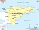
Dominican Republic's latitude and longitude is 17° to 20° N and 72° to 68° W . Below is the map of Dominican Republic showing major towns, roads, airports with latitudes and longitudes plotted on it.
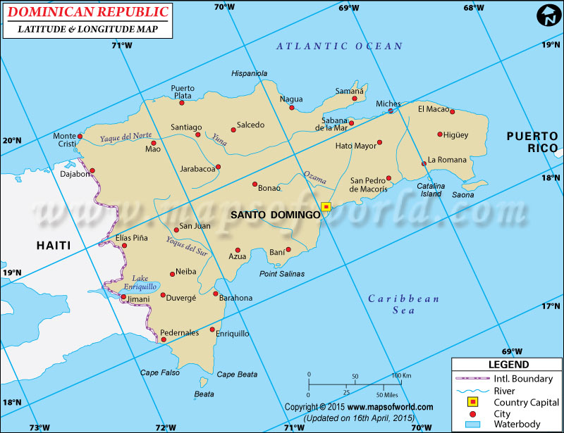
Dominican Latitude and Longitude Map Haiti Lat Long Puerto Rico Lat Long
Description : Find Dominican Republic latitude and longitude map showing comprehensive details including cities, roads, towns, airports and much more. Disclaimer
×

Disclaimer  :  All efforts have been made to make this image accurate. However MapSherpa, Inc, its directors and employees do not own any responsibility for the correctness or authenticity of the same.


Search For Latitude & Longitude Map

By Country

Or

Latitude

Longitude

Or

Area

* Put South & West values with minus ( - ) sign.

The island nation of the Dominican Republic spans across the latitude and longitude of 17° to 20°N and 72° to 68°W respectively.

The latitude and longitude position of the Dominican Republic makes it a part on the eastern side of the island of Hispaniola in the Caribbean. The total area of the island nation of the Dominican Republic is 48730 kilometer square where Duarte Peak is the highest point. The latitude and longitude of the capital nation of Dominican Republic, which is Santa Duarte , is respectively 18°30' N and 69°56' W.

The latitudinal and longitudinal attributes of the Dominican Republic lends it a tropical kind of climate where temperatures vary more frequently according to location than according to seasons. The average temperature of the Dominican Republic hovers around 25°C. The place experiences abundant rainfall while scorching temperatures are experienced mainly in August. The coldest months are normally January and February.

Latitude and Longitude of Afganistan

LocationLatitudeLongitude
Azua deCompostela18°25'N70°44'W
Bani18°16'N70°22'W
Barahona18°13'N71°07'W
Beata, C.17°40'N71°30'W
Beata, I.17°34'N71°31'W
Central,Cordillera19°15'N71°00'W
Ciudad Trujillo=Santo Domingo18°30'N69°59'W
Engano,C.18°30'N68°20'W
Enriquillo, L.18°20'N72°05'W
Hato Mayor18°46'N69°15'W
Higuey18°37'N68°42'W
La Isabela19°58'N71°02'W
 
LocationLatitudeLongitude
La Romana18°27'N68°57'W
La Vega19°20'N70°30'W
Monte Cristi19°52'N71°39'W
Nagua19°23'N69°50'W
Pedernales18°02'N71°44'W
Puerto Plata 19°48'N70°45'W
Sabana del la Mar, 19°7'N69°24'W
San Pedro de Macoris18°30'N69°18'W
Sanchez19°15'N69°36'W
Santiagode los Cabelleros19°30'N70°40'W
Santo Domingo D18°30'N69°59'W
Saona I.18°10'N68°40'W

Last Updated on: November 10th, 2017